
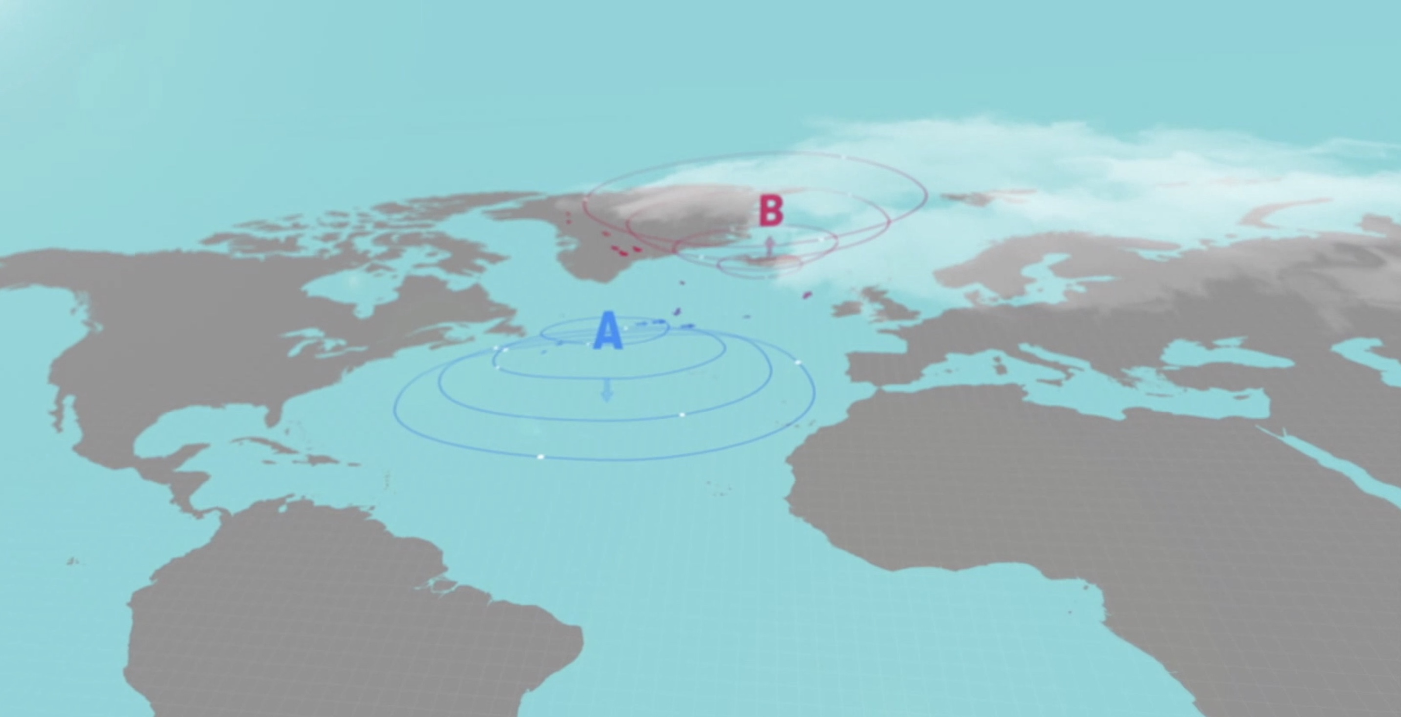
Anticyclones or high pressure centers are found between the subtropical and mild areas of the planet. The Azores anticyclone usually spreads throughout the North Atlantic and focuses on the so-called archipelago. It affects the Canary Islands significantly during almost all the year, though it withdraws occasionally between autumn and spring. In winter it is more inconstant and moves from north to south depending on the Atlantic depression. In cases of high pressure all over the ocean, it usually moves to the north of the islands, and the other way round in summer. However, its predominance is extremely high, as more than a week without showing up is rare.
When the winter approaches, so does the anticyclone, which may be placed on the islands or close to them; this causes the trade wind regime to decrease and disappear.
Trade Winds
The intensity of the trade winds varies in relation to the shift of the Azores anticyclone throughout the year. When the distance between the center of the anticyclone and the Canary Islands is shortened, the pressure gradient usually increases (isobars together), so the intensity of the trade winds also increases considerably.
Seasons
In winter the situation is more changeable more than in summer. The center of the anticyclone often moves to the north and away from the Canary Islands, thereby leaving the islands to the south of high pressures. In this case, a wind regime with East to Southeast component appears weakening the action of the trade winds, reducing cloudiness and even dragging suspended dust particles from the Sahara. This is due to the fact that the air mass is less humid because of the African influence and the short distance traveled in contact with the sea.
On the other hand, the winds are more intermittent in direction and intensity due to the anticyclone oscillation. In summer, the anticyclone moves to the northwest of the Canary Islands, in the Azores, generating more intense trade winds and giving rise to the sea of clouds, formed by the characteristic stratocumulus, which are so common in the northern slopes of the Archipelago.
When the anticyclone withdraws, so does the daily inversion layer, enabling flights at higher altitude. The situation is more unstable and development clouds may appear at noon but the sea of clouds disappears, so such conditions are better for Cross Country flights.
The Azores anticyclone determines the direction of the wind in the Islands by creating a constant northern airflow following the course of the isobars. It is the trade wind regime blowing across the Atlantic Ocean towards the Caribbean Sea. We can say that trade winds are born in the Canary Islands, they are the wind of the Canary Islands.
Conclussions:
The Azores Anticyclone, a high-pressure system located in the North Atlantic, plays a crucial role in the paragliding conditions of the Canary Islands. This weather pattern significantly influences the region’s trade winds, affecting paragliding activities throughout the year.
What is the Azores Anticyclone?
The Azores Anticyclone, also known as the Azores High, is a dominant high-pressure system situated between the subtropical and temperate zones. It frequently impacts the Canary Islands, although its influence wanes occasionally from autumn to spring. During winter, this anticyclone’s position can vary, impacting the trade wind regime and overall weather conditions.
Impact on Trade Winds
The Azores Anticyclone directly affects the intensity of the trade winds in the Canary Islands. When the anticyclone is closer to the islands, the pressure gradient between the high-pressure system and the Canary Islands tightens, leading to stronger trade winds. Conversely, when the anticyclone shifts further away, particularly in winter, the trade winds weaken, and the wind direction can shift to the east or southeast.
Seasonal Variations
- Winter: The anticyclone may move northward, reducing trade winds and allowing for more variable wind directions. This can lead to clearer skies and less cloud cover but may also bring dust from the Sahara due to decreased humidity.
- Summer: The anticyclone typically shifts northwest, enhancing trade winds and creating the characteristic sea of clouds, or stratocumulus, on the northern slopes of the islands. This pattern supports stronger and more consistent flying conditions.
Effects on Paragliding
- Winter Conditions: With the anticyclone closer to the islands, the reduction in trade winds can improve visibility and create favorable conditions for high-altitude flights. However, variable wind directions and potential dust can affect flight stability.
- Summer Conditions: Increased trade winds and the presence of the sea of clouds can provide exciting flying conditions. The consistent northern airflow helps maintain stable paragliding environments, though the inversion layer’s presence may limit high-altitude flying.
The Azores Anticyclone is a key factor in determining paragliding conditions in the Canary Islands. Its influence on trade winds and weather patterns shapes the flying experience year-round. Understanding its impact helps pilots anticipate conditions and optimize their paragliding adventures. Joining a master 5 days paragliding course in Gran Canaria will help you understanding a lot more about this phenomena.